If stepping onto a trail before coffee or squeezing in river time after work sounds like your ideal day, Reno should be on your shortlist. The city sits where the Truckee River meets the Sierra Nevada, which means you can pair urban convenience with fast access to trails, bike routes and alpine adventures. In this guide, you’ll learn which neighborhoods put you closest to daily outdoor fun, what trade-offs to consider, and how to plan for Reno’s four-season lifestyle. Let’s dive in.
Why Reno works for outdoor living
Reno’s geography makes outdoor time part of your routine. The Truckee River runs through the heart of the city, and many neighborhood parks and trailheads sit within about 5 to 30 minutes of central Reno. Major Sierra destinations, including Lake Tahoe and area ski resorts, are generally about 30 to 60 minutes by car depending on conditions.
You’ll experience four true seasons. Summers are warm and dry with bright high-desert sun, and winters shift most snow to higher elevations. For park maps, trail rules and programming, explore the City of Reno Parks and Recreation and Washoe County Regional Parks and Open Space sites. To track seasonal events and regional recreation ideas, scan Visit Reno Tahoe. For current forecasts, mountain advisories and smoke alerts, use the National Weather Service Reno office.
Neighborhoods to know
Downtown and Midtown: River-first routine
If you want a walkable base with instant river access, Downtown and Midtown deliver. You can jog or bike along the Truckee River Trail before work, then meet friends at nearby cafés and breweries. It’s a great fit if you value urban energy and easy everyday rides or runs.
Trade-offs include less private outdoor space and some urban noise. For mountain trailheads and ski days, you’ll drive. Learn about river stewardship and events through Friends of the Truckee River.
Northwest Reno, Peavine and Somersett: Singletrack at your door
The Peavine ridgeline is a favorite for hikers and mountain bikers who want quick pre-work laps or sunset runs. You’ll also find open space at Rancho San Rafael Regional Park and broad views across the valley. Many residents choose this area to stay close to singletrack without leaving the city limits.
Expect a mix of subdivisions and planned communities. Peak times can bring busier trailheads, so plan early or midweek starts. For regional park updates and trail etiquette, check Washoe County Regional Parks and Open Space.
South, South Meadows, Damonte Ranch and Bartley Ranch: Parks plus mountain access
If you like neighborhood parks and a short drive to higher-elevation trails, this corridor balances both. You can walk or ride local paths during the week, then head to Galena Creek or the Mt. Rose corridor on weekends. Flat-water options at nearby lakes add variety for paddlers and birders.
Homes tend to be newer with planned amenities. Commutes into central Reno can vary with traffic, and summer wildfire smoke can occasionally affect outdoor plans. County-managed parks and updates are posted by Washoe County Regional Parks and Open Space.
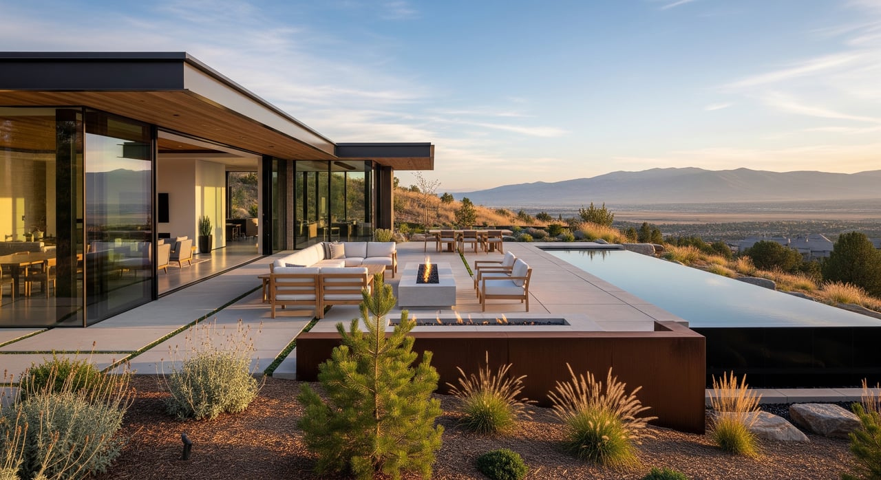
ArrowCreek, Southwest foothills and the Mt. Rose corridor: Trail-connected foothill living
Foothill neighborhoods draw you closer to mountain trail networks and the Mt. Rose Highway. You might start the day with a ridge hike, use neighborhood walking paths in the afternoon, and reach the lifts quickly on a powder day. Some communities provide on-site trail connections and expansive views.
Expect HOA presence and higher price points in many areas. Winter can bring steeper, icier roads, so plan for vehicles with appropriate tires in storm cycles. For winter operations and day planning, review Mt. Rose Ski Tahoe.
West Reno, Verdi, North Valleys and Spanish Springs: Space and quiet access
If you want room to spread out and direct reach to public lands, these semi-rural and rural pockets stand out. You can trail run long routes, road ride on quieter corridors, or stage weekend trips to Tahoe, Donner Summit or Pyramid Lake. Larger lots and equestrian options are part of the appeal in select areas.
You’ll trade convenience for privacy. Drives to services are longer, sidewalks and transit are less common, and wildland fire awareness is essential. Bookmark Washoe County Emergency Management for preparedness and evacuation guidance.
A day in the life outdoors
- Weekday urban rhythm: Jog the Truckee River Trail at sunrise, grab coffee in Midtown, then bike home along the river after work. Explore river access and stewardship via Friends of the Truckee River.
- Singletrack after hours: From Peavine-adjacent neighborhoods, squeeze in 60 to 90 minutes of climbing and flow before dinner. Use county park resources to confirm trailhead access through Washoe County Regional Parks and Open Space.
- Weekend alpine reset: Check the National Weather Service Reno forecast in the morning, then head up Mt. Rose Highway for a ski day. Review lifts, road updates and ticket info at Mt. Rose Ski Tahoe.
Drive times and access tips
- Everyday access: Many city parks and trailheads sit 5 to 30 minutes from central neighborhoods depending on traffic and your exact address. Downtown offers immediate riverside paths; foothill and northwest areas shorten drives to singletrack.
- Tahoe and ski day trips: Plan 30 to 60 minutes for many Sierra destinations in fair weather. Expect longer travel during storms or peak summer weekends. Always check the National Weather Service Reno office and resort updates before heading out.
- Bike commuting and city paths: You’ll find bike lanes and multiuse paths across the city, including the Truckee River corridor. Spring through fall is the most popular season for bike commuting. Review network plans and transit options on RTC Washoe County.
Practical planning for outdoor-first buyers
- Commute versus trail access: If immediate trailheads are your top priority, consider northwest, foothill or select south areas. If you prefer walkable urban routines and river paths, Downtown and Midtown are strong choices. Many buyers balance both with a home that shortens either the work commute or the weekend drive.
- Year-round strategy: Spring to fall is prime for river walks, cycling and local trail runs. Winter recreation concentrates at higher elevations along the Mt. Rose corridor and the Tahoe basin. For seasonal operations and snow-day plans, verify conditions at Mt. Rose Ski Tahoe.
- Gear storage and parking: If you own bikes, skis, kayaks or a small trailer, prioritize garages, sheds or driveway space. Urban condos may have limited storage, so plan for racks and on-site storage solutions.
- Pets and trail rules: Many parks and trails allow dogs on leash, with some designated off-leash areas that vary by site. Always confirm local rules with the City of Reno Parks and Recreation and Washoe County Regional Parks.
- Permits and crowding: Popular trailheads can fill early on weekends. Some regional and federal lands use parking passes or permit systems. Check the U.S. Forest Service Lake Tahoe Basin Management Unit for trailhead access and permit details.
- Wildfire and smoke readiness: Wildfire season can bring air quality impacts and changing access. Learn evacuation routes, create defensible space where applicable and monitor alerts through Washoe County Emergency Management and the National Weather Service Reno office.
- Water and drought awareness: Reservoir levels and flows can affect certain activities like paddling or angling. For fishing regulations and seasonal guidance, start with the Nevada Department of Wildlife.
How to choose your Reno base
Start with your daily rhythm. Do you picture a riverside jog and café walk, or do you want to roll your mountain bike from the garage to singletrack? List your must-haves, like garage storage, proximity to specific trailheads or an easier winter drive to Mt. Rose.
Then tour neighborhoods at the times you’ll actually use them. Visit a Peavine trailhead on a weekday evening. Walk the river path at sunrise. Drive the Mt. Rose corridor on a snowy morning to see what winter access feels like. A few real-world laps will clarify your priorities quickly.
If you want a local guide who understands both the lifestyle and the logistics, we’re here to help. As a boutique Reno team backed by RE/MAX resources, the L Clarke Group pairs neighborhood-level insight with a process built for smooth, low-stress closings. When you’re ready, reach out to L Clarke Group to compare neighborhoods, tour on your schedule and map out next steps.
FAQs
What makes Reno ideal for outdoor-focused living?
- Reno combines riverfront paths with fast drives to Sierra trailheads, plus four distinct seasons that support biking, hiking, paddling and winter sports.
Which Reno neighborhoods are closest to daily trails?
- Northwest near Peavine, ArrowCreek and parts of South Meadows offer short drives or direct access, while Downtown provides immediate Truckee River path access.
How long does it take to reach Lake Tahoe or ski areas?
- Many Tahoe destinations and ski resorts are realistic day trips, often about 30 to 60 minutes by car depending on weather and traffic.
Can I bike-commute year-round in Reno?
- Many riders commute spring through fall; winter riding depends on snow and ice. Review bike routes and transit options on RTC Washoe County.
How does wildfire smoke affect outdoor plans?
- Regional wildfire events can limit outdoor activity at times. Monitor air quality and alerts via the National Weather Service Reno office and local agencies.
Do I need a 4WD vehicle for winter trail access?
- For most nearby trailheads in good conditions a standard vehicle is fine. For higher elevations in storms, winter tires or four-wheel drive are recommended.